Construction, Mapping & Infrastructure — Building Smarter From the Sky
- Michael Crouse
- Feb 9
- 2 min read

Introduction
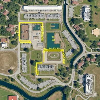
Modern construction projects move fast and involve multiple stakeholders, timelines, and changing site conditions. Drone technology gives project teams a reliable, real-time view of their job sites—improving planning, documentation, and accountability. As a licensed drone pilot, I’ve seen how aerial data replaces assumptions with measurable, visual facts that support better decisions.
AVA Drone Services partners with builders, engineers, and infrastructure professionals to provide consistent, professional aerial data that keeps projects moving forward. (Ortho mosaic mapping coming soon.)

Construction Progress Monitoring
Scheduled drone flights provide a visual timeline of a construction project from start to finish. These flights document site changes accurately and consistently, making them valuable for internal teams and external stakeholders.
What Drone Monitoring Includes:
Regular aerial photo and video captures at defined milestones
High-resolution images showing work completed versus planned
Overhead views that reveal site organization and material placement
Consistent flight paths for reliable comparison over time
Why It Matters:
Creates clear visual proof of progress for investors and clients
Reduces disputes by providing objective, time-stamped documentation
Improves communication between project managers, contractors, and owners
Primary Benefit: Reduced disputes, improved transparency, and stronger project accountability.
Site Planning & Pre-Construction Surveys
Before excavation or equipment mobilization begins, drone-based mapping provides critical insights into site conditions. Aerial surveys help teams understand terrain, elevation changes, drainage patterns, and access limitations.

Survey Capabilities:
Detailed aerial site overviews for planning and layout
Identification of slopes, low areas, and drainage paths
Mapping of access roads and equipment staging areas
Baseline documentation before construction begins
Why It Matters:
Helps teams plan efficiently and avoid design conflicts
Reduces costly delays caused by unexpected site conditions
Supports safer and more organized job site setup
Primary Benefit: Better planning, improved site readiness, and fewer costly surprises.
Stockpile & Volume Measurements
Accurate material tracking is critical to controlling costs on construction and industrial sites. Drones use photogrammetry to calculate material volumes quickly and precisely—often in a fraction of the time required by traditional methods.
Measurement Capabilities:
Aerial data capture of stockpiles from multiple angles
Volume calculations for gravel, soil, sand, and aggregate
Repeatable measurements for tracking material usage over time
Digital records that support inventory and reporting needs

Why It Matters:
Improves inventory accuracy and cost forecasting
Reduces labor time spent on manual measurements
Supports better purchasing and material management decisions
Primary Benefit: Accurate inventory tracking, reduced labor, and improved cost control.
AVA Drone Services delivers precise mapping and volume calculations tailored for construction, mining, and industrial clients.
Conclusion
Drone technology has become an essential tool for modern construction and infrastructure projects. With accurate aerial data, consistent documentation, and reliable measurements, teams can stay on schedule, control costs, and communicate clearly at every stage.
AVA Drone Services brings professional aerial solutions to every phase of construction—supporting smarter planning, safer operations, and better project outcomes from the sky down.


Comments